.gif)
All 25 Listed UNESCO World Heritage Sites of Indochina/Southeast Asia Tour
Indochina has a treasure trove of UNESCO World Heritage sites, 25 in total, spread across Vietnam, Cambodia, Laos, Thailand and Myanmar. Each one offers a unique experience into the region’s rich culture, history, and natural beauty.
In Vietnam, there are eight sites, including the popular Halong Bay and Hoi An Ancient Town. Cambodia has four, with the famous Angkor Wat leading the way. Laos offers three, with Luang Prabang being a true highlight. Thailand has eight sites, from ancient cities to untouched forest sanctuaries like Sukhothai and Kaeng Krachan. And in Myanmar, two sites await, including the sacred temples of Bagan.
In this guide, we’ll take you through each of these heritage sites one by one, helping you get to know the heart and soul of Indochina—and making it easier to plan an unforgettable journey!
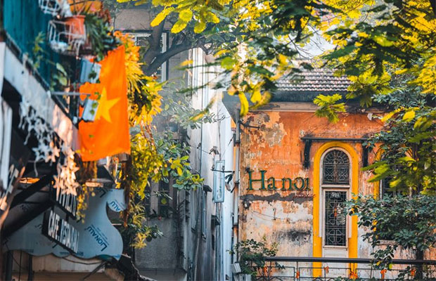
![]() All 8 Listed UNESCO World Heritage Sites in Vietnam
All 8 Listed UNESCO World Heritage Sites in Vietnam
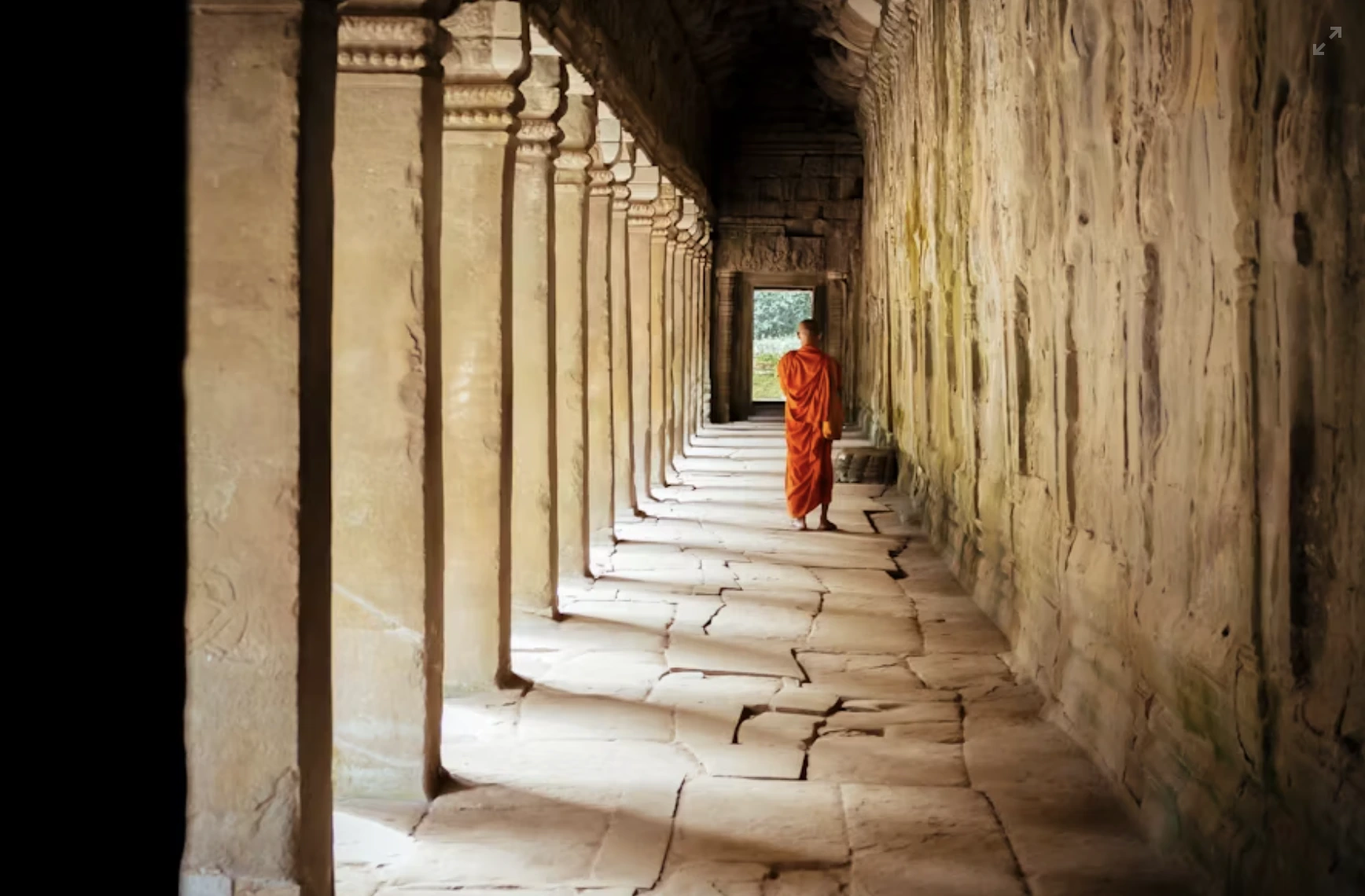
![]() All 4 Listed UNESCO World Heritage Sites in Cambodia
All 4 Listed UNESCO World Heritage Sites in Cambodia
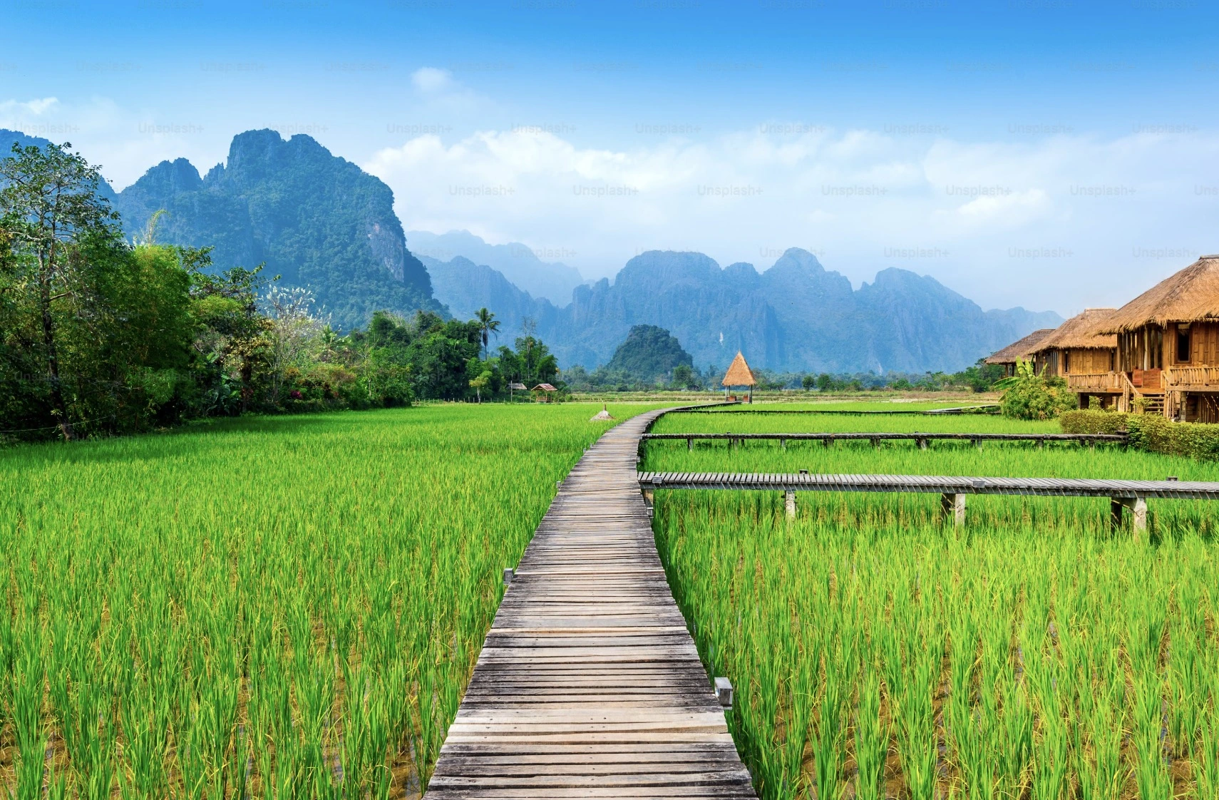
![]() All 3 Listed UNESCO World Heritage Sites in Laos
All 3 Listed UNESCO World Heritage Sites in Laos
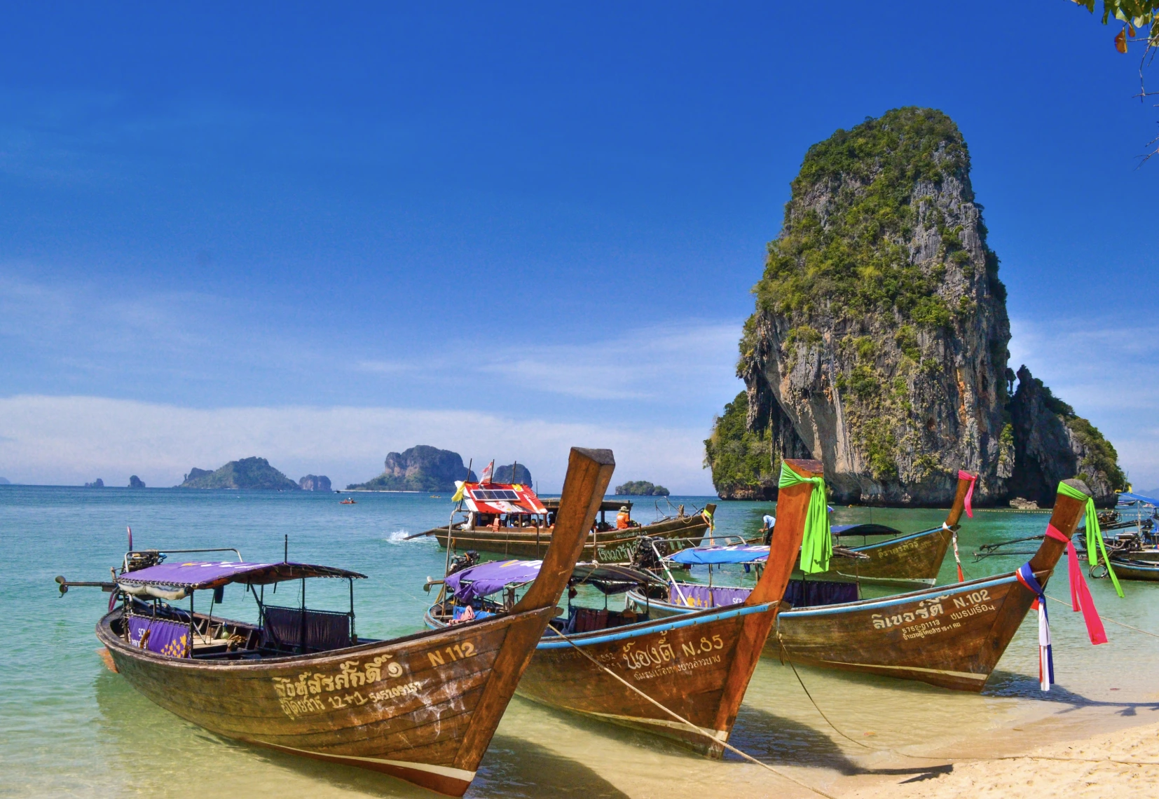
![]() All 8 Listed UNESCO World Heritage Sites in Thailand
All 8 Listed UNESCO World Heritage Sites in Thailand
All 8 Listed UNESCO World Heritage Sites in Vietnam
Vietnam is a vibrant country with a rich history, and a Vietnam tour offers the chance to explore its eight UNESCO World Heritage sites, from ancient citadels to stunning landscapes.
Central Sector of Imperial Citadel of Thăng Long
The Central Sector of the Imperial Citadel of Thăng Long was built in the 11th century and served as the seat of Vietnamese dynasties for over 13 centuries. Its ruins lie beneath modern Hanoi and include ancient walls, royal gardens and dragon columns, which are the most important and best-preserved part of the ancient Imperial Citadel of Thăng Long.
This citadel is a symbol of Vietnam’s long history of independence and culture. Visitors today can explore the archaeological site and museum to learn about Vietnam’s imperial past through artifacts and old bricks.

Central Sector of Imperial Citadel of Thăng Long
Citadel of the Hồ Dynasty
The Citadel of the Hồ Dynasty, in Thanh Hóa Province, was built in 1397 according to feng shui principles. This 14th-century fortress embodies the rise of neo-Confucian ideas in Vietnam. According to these principles, it was built in a landscape of great scenic beauty on an axis joining the Tuong Son and Don Son mountains in a plain between the Ma and Buoi rivers.
Its massive square walls and strategic layout show an entirely new style of imperial city that would influence later architecture. Although the Hồ dynasty ruled for a brief period, this citadel remains a remarkable example of Southeast Asian fortress design.

Citadel of the Hồ Dynasty
Complex of Huế Monuments
Hue was the imperial capital of Vietnam from 1802 to 1945 under the Nguyen dynasty. The UNESCO-listed Complex of Huế includes the walled Citadel in the city and the Forbidden Purple City that once housed the emperor. The Complex of Hue Monuments is located in and around Hue City of Vietnam and with easy access to the sea.
Outside the Citadel, along the Perfume River, lie the imperial tombs and temples built for the Nguyen emperors. These beautiful structures blend Vietnamese and European influences and preserve the culture of Vietnam’s last royal era.

Complex of Huế Monuments
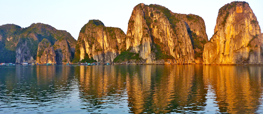
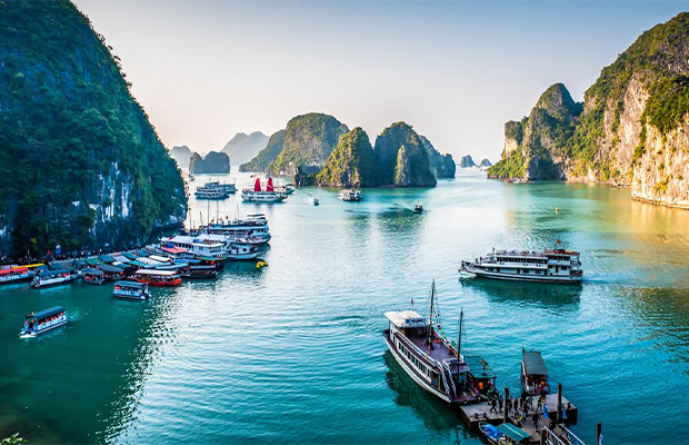
Hạ Long Bay–Cát Bà Archipelago
Hạ Long Bay–Cát Bà Archipelago spans a rugged seascape with over a thousand limestone islands and islets rising from emerald water, and is one of the best examples of marine tower karst geology on Earth.
Many of the islands have caves and stone arches, creating a magical view. The nearby Cat Ba National Park (on Cat Ba Island) adds rich forests and wildlife, making the area both beautiful and ecologically important.

Hạ Long Bay–Cát Bà Archipelago
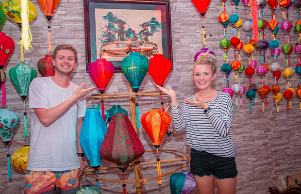
Hội An Ancient Town
Hội An Ancient Town was a vibrant trading port from the 15th to the 19th centuries and retains its original wooden shop-houses and canals. The town is an “exceptionally well-preserved” example of a Southeast Asian trading village, showing Chinese, Japanese and Vietnamese influences in its architecture.
The quiet streets of Hội An today are decorated with lanterns and criss-crossed by a river, the mix of old temples, colonial buildings, and the famous Japanese Covered Bridge, gives a feeling of stepping back in time.

Hội An Ancient Town
Mỹ Sơn Sanctuary
The Mỹ Sơn Sanctuary is a group of Cham temple ruins hidden in a lush valley. These red-brick temples were built between the 4th and 13th centuries for Hindu deities, especially Shiva.
Mỹ Sơn shows “values developed over nine centuries,” reflecting the power of the ancient Champa kingdom. Today, the site’s tall stone towers and sculptures (partly damaged by time and war) give a glimpse of Champa’s vanished civilization.

Mỹ Sơn Sanctuary
Phong Nha – Kẻ Bàng National Park
Phong Nha–Kẻ Bàng National Park is a limestone wilderness of jungles, caves and rivers. It contains some of the largest cave systems on Earth, including the famous Phong Nha cave and Son Doong, the world’s largest known cave passage.
The park’s karst landscape for its caves, underground rivers and biodiversity. The dense forests shelter animals like gibbons, tigers and rare birds, making Phong Nha–Kẻ Bàng both geologically and ecologically outstanding.

Phong Nha – Kẻ Bàng National Park
Tràng An Landscape Complex
The Tràng An Landscape Complex is a stunning mix of forests, rice fields and limestone karst peaks riddled with caves. Wooden boats carry visitors through river grottoes under sheer cliffs. Archaeological finds show people lived here 30,000 years ago and that the site later included Vietnam’s 10th-century capital Hoa Lu.
Tràng An’s geological beauty and its cultural layers, temples, pagodas and tombs dot the valley, making it both a natural wonder and a cultural landscape.

Tràng An Landscape Complex
All 4 Listed UNESCO World Heritage Sites in Cambodia
Cambodia is famous for its ancient temple cities, which have four UNESCO World Heritage sites to explore in a Cambodia tour, showing its long history.
Angkor Archaeological Park
Angkor Archaeological Park is the crowning jewel of Cambodia’s cultural heritage. It includes the ruins of the great Khmer capitals from the 9th to 15th centuries, most famously the temple of Angkor Wat and the stone faces of the Bayon. This vast complex has hundreds of temples and monuments, each covered in carvings and reliefs.
The temples of the Angkor area number over one thousand, ranging in scale from nondescript piles of brick rubble scattered through rice fields to the Angkor Wat, said to be the world's largest single religious monument. UNESCO describes Angkor as one of Southeast Asia’s most important archaeological sites, reflecting the empire’s wealth and devotion.

Angkor Archaeological Park
Temple of Preah Vihear
Perched on a 525-meter cliff ridge, the Temple of Preah Vihear is an 11th-century Khmer temple dedicated to Shiva. Its long central axis of sanctuaries and staircases leads up the mountain. The site is known for its outstanding stone carvings and its spectacular views of the Cambodian plains.
This site is particularly well preserved, mainly due to its remote location, and its majestic architecture still remains a symbol of faith and national heritage.

Temple of Preah Vihear
Temple Zone of Sambor Prei Kuk, Archaeological Site of Ancient Ishanapura
Sambor Prei Kuk is an archaeological park with over a hundred brick temples and towers, “the temple in the richness of the forest” in the Khmer language. It was the capital of ancient Chenla (known as Ishanapura) in the 6th–7th centuries. Many of its temple towers are octagonal, a unique design in Khmer architecture.
The stone carvings at Sambor Prei Kuk are exquisitely crafted and can be considered a forerunner of the Angkor style. These temple ruins, set in a green forest, lay the ground for the unique Khmer style of the Angkor period.

Temple Zone of Sambor Prei Kuk, Archaeological Site of Ancient Ishanapura
Koh Ker: Archeological Site of Ancient Lingapura or Chork Gargyar
Koh Ker was briefly the capital of the Khmer Empire in the 10th century. King Jayavarman IV built dozens of temples here in just 23 years, including the massive seven-tiered pyramid of Prasat Thom. The temple remains are surrounded by jungle, with towering stone pillars and lintels.
Koh Ker’s unique layout and huge stone blocks reflect a powerful royal vision. Now this remote temple complex offers a glimpse of a bold period in Khmer history.

Koh Ker: Archeological Site of Ancient Lingapura or Chork Gargyar
All 3 Listed UNESCO World Heritage Sites in Laos
Laos is a land of mountains and Mekong valleys, offering three UNESCO World Heritage sites in Laos tour that celebrate its sacred temples and mysterious landscapes.
Town of Luang Prabang
The historic town of Luang Prabang was the royal capital of Laos and is famous for its many gilded Buddhist temples and French colonial villas. It sits on a peninsula formed by the Mekong and Nam Khan rivers. Luang Prabang is known for its remarkably well-preserved architecture, which blends traditional Lao styles with 19th- and 20th-century European influences.
The city was also the centre of Buddhism in the region. Luang Prabang takes its name from a statue of Buddha, the Prabang, offered by Cambodia. The whole old city feels tranquil and historical.

Town of Luang Prabang
Vat Phou and Associated Ancient Settlements within the Champasak Cultural Landscape
Vat Phou is a Khmer temple complex in southern Laos set below a sacred mountain. The Champasak cultural landscape, including the Vat Phou Temple complex, is a remarkably well preserved planned landscape more than 1,000 years old. The layout follows a sacred axis from the mountaintop to the river, in line with Hindu beliefs, with temples, shrines and ancient irrigation works stretching nearly 10 km.
Two planned cities on the banks of the Mekong River are also part of the site, as well as Phou Kao Mountain. The whole represents a development ranging from the 5th to 15th centuries, mainly associated with the Khmer Empire.

Vat Phou and Associated Ancient Settlements within the Champasak Cultural Landscape
Megalithic Jar Sites in Xiengkhuang – Plain of Jars
The Plain of Jars is a highland plateau in Laos dotted with over 2,100 ancient stone jars. The jars are massive and date from about 500 BC to AD 500. Archaeologists believe they were used in burial rituals. These Iron Age jars form part of a funerary complex that includes stone discs and burial mounds.
The purpose of the jars remains mysterious, which makes the site one of Laos’s most enigmatic World Heritage sites. Much of the plateau was a battleground in modern times, but today the jar fields offer an eerie, ancient landscape to explore.

Megalithic Jar Sites in Xiengkhuang – Plain of Jars
All 8 Listed UNESCO World Heritage Sites in Thailand
Thailand tour offers a wealth of historical and natural treasures, it has eight UNESCO World Heritage sites, including ancient capitals and vast wildlife sanctuaries.
Historic Town of Sukhothai and Associated Historic Towns
The Sukhothai Historical Park preserves the ruins of the first Thai kingdom (1238–1438) in northern Thailand. Its temples, palaces and Buddha statues are the earliest examples of Thai architecture and art.
Sukhothai and its sister sites (Si Satchanalai and Kamphaeng Phet) represent the birth of Thai civilization. Highlights include Wat Mahathat, where a stone Buddha head rests on a lotus bud. Walking among the ruins of Sukhothai feels like stepping into a living history museum.

Historic Town of Sukhothai and Associated Historic Towns
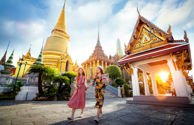
Historic City of Ayutthaya
The Historic City of Ayutthaya was Thailand’s capital from 1350 until its destruction in 1767. Built on an island at the confluence of three rivers, it became a powerful international trade hub. Its ruins – royal temples, palace walls and Buddha statues – are spread across a peaceful park.
Ayutthaya is an outstanding example of a cosmopolitan city blending Asian and foreign influences. Temples like Wat Mahathat (with a Buddha head entwined in tree roots) and Wat Chaiwatthanaram (with its grand prang towers) illustrate its former glory.

Historic City of Ayutthaya
Thungyai–Huai Kha Khaeng Wildlife Sanctuaries
The Thungyai–Huai Kha Khaeng Wildlife Sanctuaries in western Thailand are a vast area of tropical forest, covering over 6,200 square kilometers. These parks are still almost completely natural and contain nearly every type of forest found in continental Southeast Asia.
They harbor 77% of Southeast Asia’s large mammal species, 50% of large birds and 33% of terrestrial vertebrates. Many endangered animals – including tigers, Asian elephants and gaurs – roam here, making Thungyai–Huai Kha Khaeng a living treasure of wildlife.

Thungyai–Huai Kha Khaeng Wildlife Sanctuaries
Ban Chiang Archaeological Site
Ban Chiang in northeast Thailand is one of Southeast Asia’s most important prehistoric settlements. Occupied around 1500–500 BC, this site has yielded evidence of early wet-rice farming, pottery and bronze metalworking.
The site’s red-painted pottery and bronze artifacts demonstrate that its people had developed advanced crafts. Visiting Ban Chiang’s small museum and earthen mounds allows visitors to appreciate this ancient community.

Ban Chiang Archaeological Site
Dong Phayayen–Khao Yai Forest Complex
The Dong Phayayen–Khao Yai Forest Complex spans a mountainous area over 230 km from east to west in Thailand. It includes five contiguous national parks and sanctuaries.
The complex hosts more than 800 animal species – including tigers, elephants and leopards – making it one of the richest wildlife areas in Asia. Many of these species are globally threatened. These forests are some of the last refuges for large mammals in mainland Southeast Asia.

Dong Phayayen–Khao Yai Forest Complex
Kaeng Krachan Forest Complex
The Kaeng Krachan Forest Complex covers a huge swath of forest on Thailand’s western border. It is part of the Tenasserim Range and contains semi-evergreen and evergreen forest. The site is known for its incredible biodiversity.
It shelters tigers, Asian elephants, Siamese crocodiles and eight cat species (from tigers and leopards to clouded panthers). Many plants and animals here are endemic or threatened. This forest is one of Thailand’s last wild frontiers.

Kaeng Krachan Forest Complex
The Ancient Town of Si Thep and its Associated Dvaravati Monuments
Si Thep is an archaeological site in central Thailand that was once a Dvaravati city from the 6th to 10th centuries. It includes two fortressed towns (inner and outer) with moats, as well as a large hilltop temple (Khao Klang Nok) and cave temples.
These sites illustrate the architecture, artistic traditions and religious diversity of the Dvaravati period. In particular, the “Si Thep School” art style made its mark on other cultures. The ruins here give insight into early Thai urban life.

The Ancient Town of Si Thep and its Associated Dvaravati Monuments
Phu Phrabat, a testimony to the Sīma stone tradition of the Dvaravati period
The Phu Phrabat Historical Park preserves an outstanding collection of ancient boundary stones and rock art. These boundary stones (called "sema") were erected during the Dvaravati period (7th–11th centuries CE) to mark the sacred limits of temple areas.
Phu Phrabat holds the largest in situ group of Dvaravati sema stones in the world. Many of the sema and painted rock shelters here still remain in the park, making it a uniquely preserved religious landscape.

Phu Phrabat, a testimony to the Sīma stone tradition of the Dvaravati period
All 2 Listed UNESCO World Heritage Sites in Myanmar
Myanmar’s rich history is captured in its two UNESCO World Heritage sites, both featuring remarkable ancient cities and temples to explore in a Myanmar tour.
Pyu Ancient Cities
The Pyu Ancient Cities comprise the archaeological sites of Halin, Beikthano and Sri Ksetra in Myanmar. These were brick-walled cities with moats built in an irrigated plain, inhabited by the Pyu people between roughly 200 BC and 900 AD. The ruins include palace citadels, Buddhist stupas, burial grounds and evidence of ancient water management.
UNESCO recognizes the Pyu Ancient Cities as evidence of one of Southeast Asia’s earliest civilizations, which helped spread Buddhism and trade between India and China.

Pyu Ancient Cities
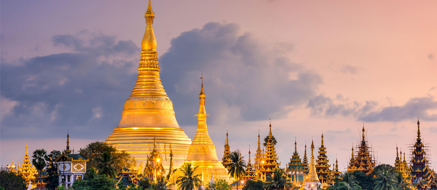
Bagan
Bagan is an ancient city on the central plains of Myanmar, home to a sacred landscape of temples, featuring an exceptional array of Buddhist art and architecture. Between the 11th and 13th centuries, Bagan was the capital of a powerful empire, and rulers built thousands of pagodas and monasteries in devotion.
Hundreds of these brick stupas and temples still remain, such as the golden Ananda Pagoda and the Shwezigon Pagoda, which testify to the religious fervor of the early Burmese kingdom.

Bagan
Conclusion
That’s all 25 UNESCO World Heritage Sites in Indochina. From Vietnam’s bustling old towns to Cambodia’s jungle temples, Laos’s mountains, Thailand’s ancient cities and Myanmar’s temple plains, each site shows a special part of the region’s heritage, and is a jewel of history or nature.
Start planning your trip in Indochina, and don’t forget your camera- you’ll want to remember every second! Safe travels and enjoy discovering the wonders of this beautiful region! If you have any other questions or information you want to know, just contact us.

More Related Indochina Travel Planning Articles


Most Popular Indochina Tour Packages
-
 13 Days Glimpse of Vietnam Cambodia Laos Thailand and Myanmar Tour
Hanoi – Siem Reap – Luang Prabang – Bangkok – Yangon
During this period, you will visit the hottest cities, including Hanoi, Siem Reap, Luang Prabang, Bangkok, and Yangon. What ...
-
.jpg) 32 Days Cambodia Laos Vietnam Myanmar and Thailand Tour with Beach Relaxing
32 Days Cambodia Laos Vietnam Myanmar and Thailand Tour with Beach RelaxingSiem Reap – Battambang – Phnom Penh – Vientiane – Luang Prabang – Hanoi – Sapa – Halong Bay – Hanoi – Yangon – Mandalay – Bagan – Mandalay – Bangkok – Khao Sok – Koh Phangan – Koh Samui – Phuket – Phi Phi Island - Phuket
A 32-day trip to five Southeast Asian countries provides you with a variety of different experiences. You can hike in Sapa ...
-
.jpg) 34 Days Thailand Cambodia Vietnam Laos and Myanmar Tour with Mekong Cruise
34 Days Thailand Cambodia Vietnam Laos and Myanmar Tour with Mekong CruiseBangkok – Siem Reap – Phnom Penh – Saigon – Hoi An – Hanoi – Sapa – Halong Bay – Vientiane – Vang Vieng – Luang Prabang – Pak Beng – Huay Xai – Chiang Rai – Chiang Mai – Mandalay – Bagan – Inle Lake - Yangon
A 34-day, nearly one-month trip to Southeast Asia will be an excellent choice for you to relax and unwind. Many tourists ...
-
.jpg) 37 Days Best of Myanmar Thailand Cambodia Vietnam and Laos Tour
37 Days Best of Myanmar Thailand Cambodia Vietnam and Laos TourYangon – Mandalay – Bagan – Mandalay – Bangkok – Siem Reap – Sihanoukville – Koh Rong Island – Phnom Penh – Saigon – Da Nang – Hoi An – Hanoi – Halong Bay – Hanoi – Luang Prabang – Pak Beng – Huay Xai – Chiang Rai – Chiang Mai - Phuket
A more than one month trip to Southeast Asia awaits you to explore. An ultra-long journey is suitable for travelers who have ...
-
 42 Days Exclusive Tour of Myanmar Thailand Laos Cambodia and Vietnam
Yangon – Bago – Inle Lake – Bagan – Mandalay – Bangkok – Ayutthaya – Sukhothai – Chiang Mai – Luang Prabang – Pakse – Vientiane – Phnom Penh – Siem Reap – Hanoi – Halong Bay – Hoi An – Saigon – Mekong Delta – Can Tho – Phu Quoc
A 42 day super experience tour will take you to deeply understand Southeast Asian customs! Look forward to temple city of ...
Ask Us A Question For Free


.jpg)